

CHINAHEALTH
NEWS CENTER
Learn more >
Orientation Training Part 2-Representation of Map Symbols and Colors
Release time:
2020-07-30 16:21
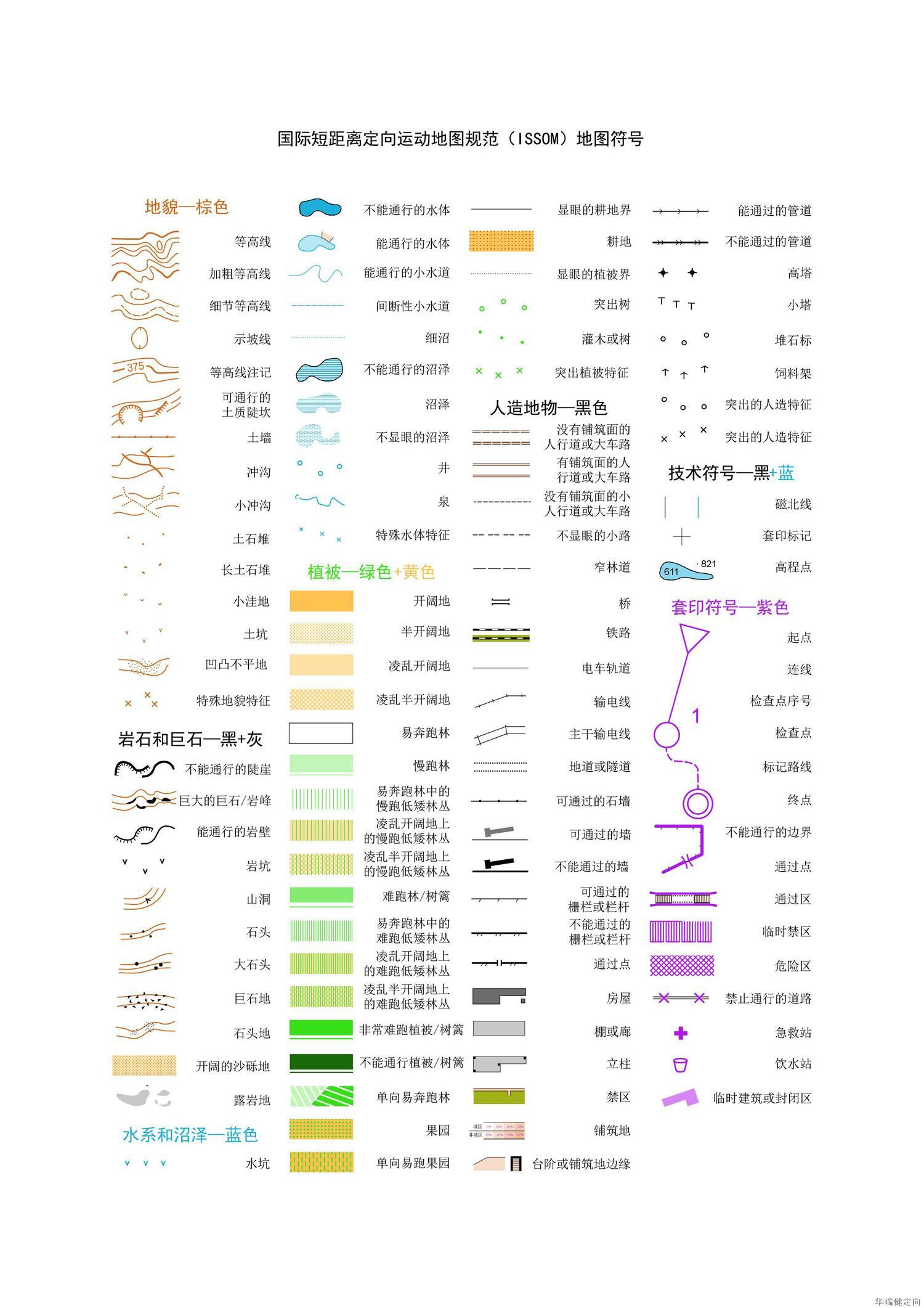
1. International Short-distance Orienteering Map Specification (ISSOM) map symbols
2. International Orienteering Map Specification (ISOM) Hiking Orienteering Map Symbols

3. The following is explained by the ISSOM2007 standard:

1. Landform


2. Rocks and stones


3. Water system and wetland


4. Vegetation


Related news

undefined
Shenzhen Huaruijian Industry Co.,Ltd.
Shenzhen Headquarters: 3/F, Building 1, Jinda Technology Center, No. 8, Kefeng Road, Science Park, Nanshan District, Shenzhen

Follow us
Taobao Mall
Copyright © 2022 Shenzhen Huaruijian Industry Co.,Ltd. All Rights Restored